North Powder River Timber Property
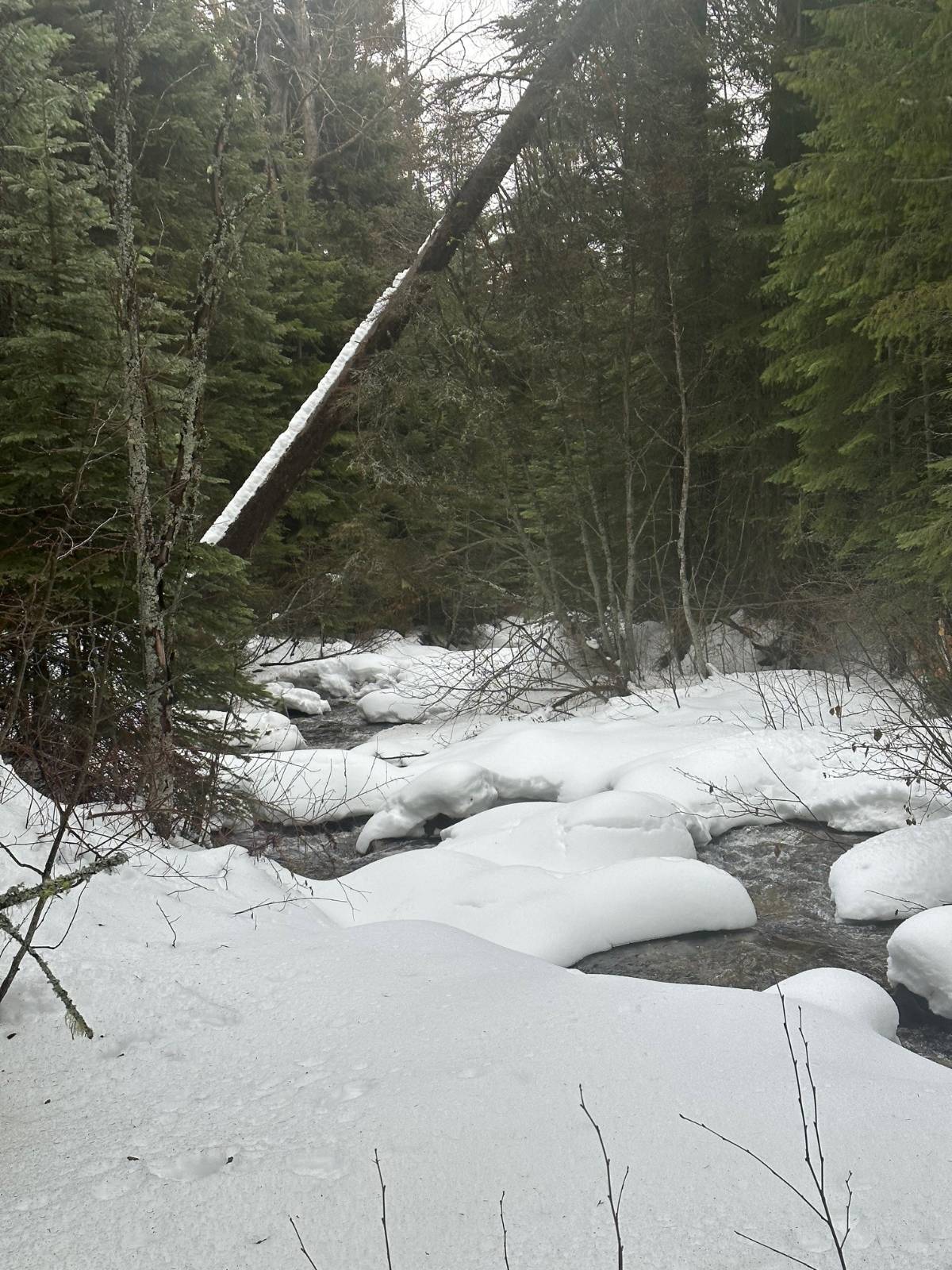
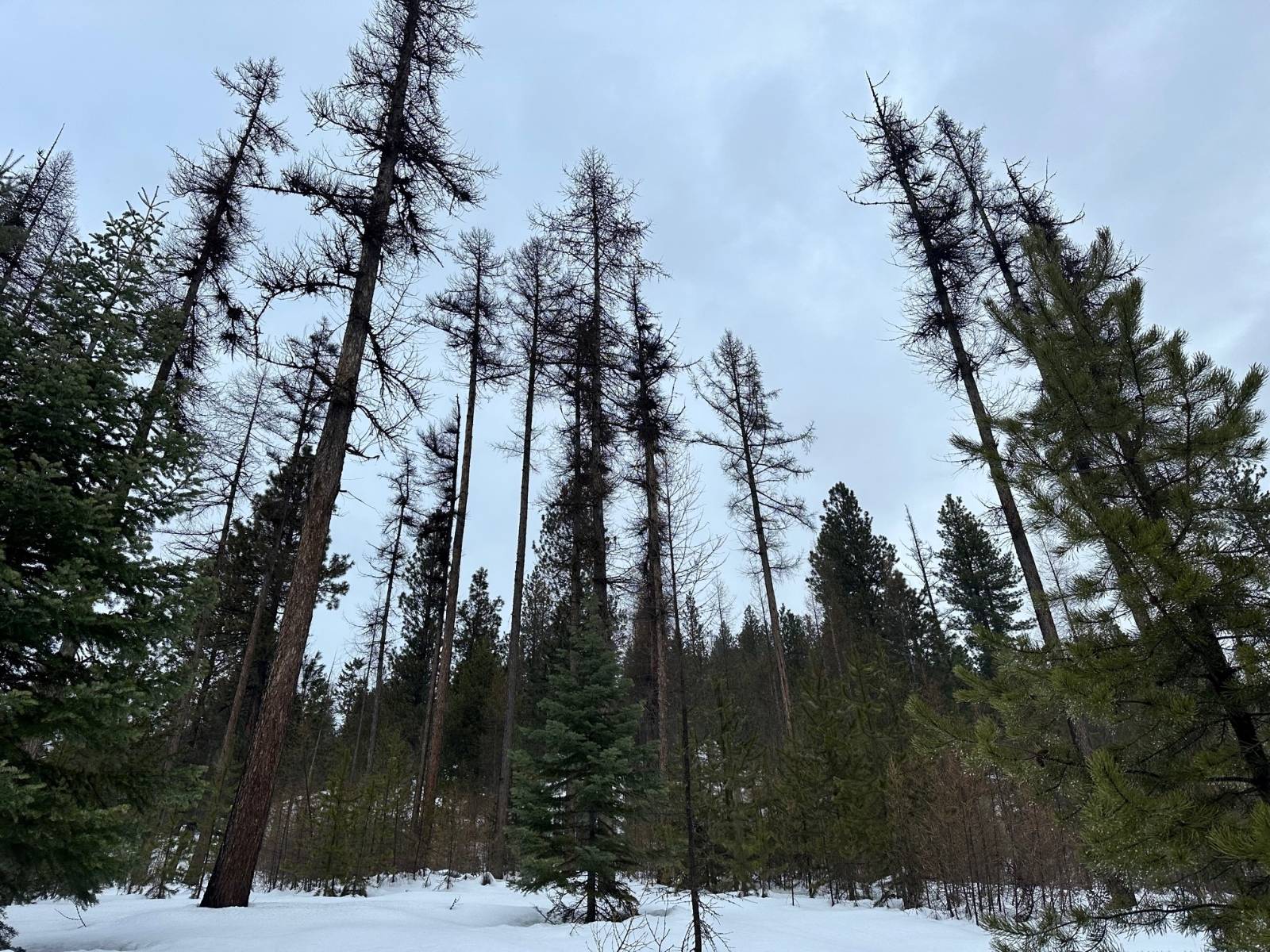
At the base of Twin Mountain this property is the gateway to the Elkhorn Mountains known to the old timers as the access road over the mountains to Sumpter. Known as the "Old Stagecoach Road". The property boasts 180 acres of well managed timber. It is estimated to have been logged about 25 years ago. Well managed, this property contains a significant amount healthy Western Larch, Douglas Fir, Spruce and other species. Hunting, fishing, camping, summer or winter recreation, this property can provide it. Sellers have applied for a "lot of record" to provide the ability to construct a dwelling. Location: Foothill Road West of Haines, and not far from the Anthony Lakes highway. T07SR38E TL 5500 Access: From Baker City turn right onto US-30 W/10th St 12.5 mi Turn left onto Haines Cemetery Ln/Muddy Creek Rd 1.3 mi Turn right onto Muddy Creek Rd 0.3 mi Slight left onto Muddy Creek Ln 2.6 mi Continue onto Foothill Rd 1.0 mi Turn left onto Bulger Flat Ln 1.6 mi La Grande 39 mi Ontario 89 mi Boise, ID 144 mi TriCities, WA 156 mi Acreage: The Timber property consists of 180 acres. Mostly timbered. The North Powder River runs North to South though the entire length of the property. Riparian area is a mix of conifers and rushing water. Mansfield Ditch diverts out of the river and transects across the property providing a great opportunity for late season water access for all kinds of wildlife species. Water: Water is supplied by two different ditches. Water Rights: A timber property with no known water rights. Grazing/Fencing: The property is NOT perimeter fenced. Climate/Elevation/Rainfall: 4600' Elevation Average Temperature Baker (Recorded in the period 1951-1981) (All units are Degrees Fahrenheit Month Avg Daily Max Avg Daily Min Avg Growing Deg Days January 35.7 19 27.4 38 February 42.6 23.6 27.4 51 March 49.7 26.5 38.1 71 April 59.5 31.5 45.5 194 May 68.3 38.6 53.5 419 June 76.4 45.1 60.8 624 July 85.9 50.3 68.1 871 August 84.3 48.4 66.6 825 September 76.5 41.7 59.1 573 October 62.9 33.8 48.8 270 November 46.8 27 36.9 53 December 37.6 21 29.3 17 Precipitation Month Average Inches Water Average Snowfall Inches January 1.17 7.4 February .76 3.8 March 1.04 2.5 April .92 .8 May 1.54 .2 June 1.33 0 July .69 0 August .68 0 September .69 0 October .69 .3 November 1.18 3.7 December 1.37 7 Total 12.06 25.7 Growing Season days Baker (data was recorded from 1951 - 1981) Probability Higher than 24 deg F Higher than 28 deg F Higher than 32 deg F 9 yr


 ;
; ;
; ;
; ;
;